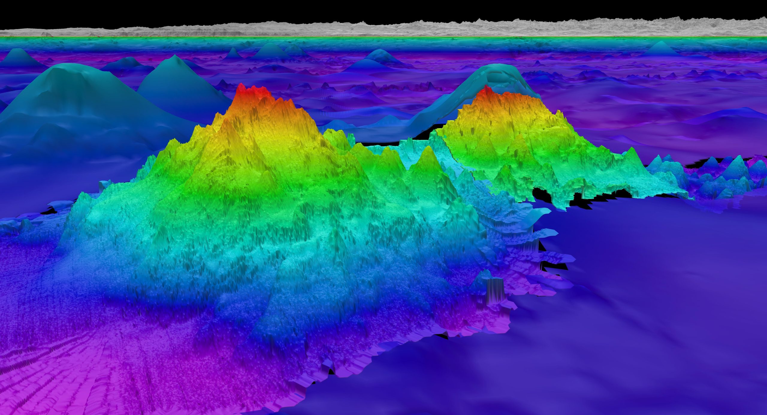
A NASA Satellite Just Found Roughly 56,000 Mountains Nobody Knew Were There. They Were All Underwater.
A NASA-supported research team has used data from the Surface Water and Ocean Topography satellite to produce the most detailed map of the ocean floor ever created, identifying close to 100,000 seamounts worldwide, more than double the roughly 44,000 that had previously been catalogued. The findings, led by geophysicist David Sandwell of the Scripps Institution of Oceanography, were published in the journal Science.
The scale of what remains unmapped is part of what makes the discovery significant. Oceans cover roughly 71% of Earth’s surface, yet only about a quarter of the seafloor has ever been directly surveyed using ship-based sonar, the method that produces the most precise measurements available. Filling in the rest of the map has depended on satellite data instead, and until now, that data could only reliably detect the very largest underwater features.
The technique behind the new map relies on gravity rather than direct observation.Seamounts and other seafloor formations have more mass than the terrain surrounding them, which means they exert a very slightly stronger gravitational pull. That pull causes water directly above the feature to pile up by a tiny amount, creating a bump in the sea surface only centimeters tall. SWOT, a collaboration between NASA and the French space agency CNES, is sensitive enough to detect that bump and precise enough to infer the size and shape of whatever seafloor feature produced it.
“The SWOT satellite was a huge jump in our ability to map the seafloor,” Sandwell said. He has been using satellite data to study the ocean floor since the 1990s and said the leap in resolution this time was substantial. Earlier generations of ocean-observing satellites could reliably detect only seamounts taller than about a kilometer. SWOT can pick up features less than half that height, which is what allowed the count of known seamounts to jump from 44,000 to nearly 100,000, alongside more than 200,000 newly identified abyssal hills, smaller seafloor formations that are even more numerous and previously far harder to detect from space.
The map has value well beyond cartography for its own sake. Seamounts and abyssal hills shape how heat and nutrients move through the deep ocean, and they frequently create the kind of nutrient-rich conditions that attract concentrated marine life, making them ecologically significant even when they never breach the surface. They also influence deep-sea currents and tides, and mapping their locations more precisely could improve everything from submarine navigation to the placement of undersea communication cables. Yao Yu, a marine geophysicist at Scripps who led related work on the mapping project, described the level of detail simply: “It’s just amazing.”
The satellite was not originally built for this purpose. SWOT launched in December 2022 with a primary mission of measuring water height across nearly all of Earth’s surface, including lakes and rivers, in order to track flood progression and changes in freshwater systems. Mapping the seafloor turned out to be a byproduct of that same sensitivity to minute changes in water height, and researchers say the satellite’s performance has exceeded expectations since launch. “There will be breakthrough results for years to come,” said Lee-Lueng Fu, SWOT’s project scientist at NASA’s Jet Propulsion Laboratory.
The work is far from finished. Sandwell’s team is now using a year’s worth of SWOT data to calculate the actual depth of the newly identified features, a separate step from simply confirming their existence and location. The broader goal, a complete ship-based sonar map of the entire seafloor by 2030, remains well out of reach on current timelines. Sandwell has acknowledged as much directly: that full mapping effort will not be done by then. In the meantime, satellite data like this is filling in a picture of Earth’s own surface that, in large stretches, has remained less detailed than publicly available maps of the surface of the moon.